This linear route connects the traditional village of Tunte (San Bartolomé de Tirajana) with the bottom of the spectacular Fataga Ravine, ending at the aboriginal settlement of Arteara. The trail starts from the higher part of the village, heading south along ancient muleteer paths, passing through cultivated terraces and palm groves.
The path traverses a changing landscape: from the gentle cultivated hills of Tunte and Taidía, to the winding descent toward Fataga, one of the most picturesque villages in southern Gran Canaria. Along this section, you can observe tile kilns, threshing floors, washhouses, and well-preserved rural architecture.
After crossing the ravine, the route continues toward Los Caserones, a group of cave-houses and ancient terraces that have been transformed over the centuries. Finally, it reaches Arteara, the symbolic endpoint of the route, framed by palm groves and its important pre-Hispanic necropolis. The volcanic and dry landscape of the south contrasts with the lush upper sections, making this route a complete experience through the history, geography, and culture of Tirajana.
This route is ideal for delving into the island’s geographical and cultural core. It begins in the village of Tunte, whose church reflects the conquest and Christianization process. After climbing cobbled streets, you reach a cemetery with a neoclassical facade and a viewpoint with impressive views of the Tirajana Caldera.
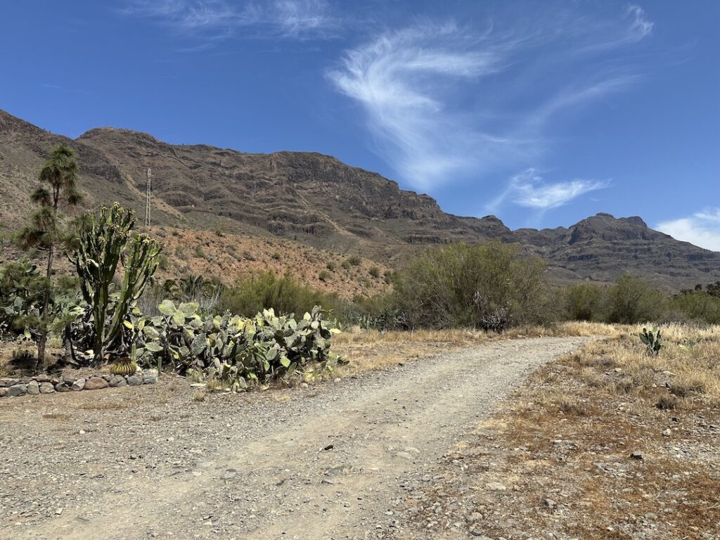
The route continues along a long stretch of the Camino de Santiago, crossing slopes between Tirajana and Fataga. The environment changes from intense green to the reddish and yellow tones typical of the arid Fataga valley. After visiting the picturesque village of Fataga, the trail descends into the ravine bottom and then ascends the western slope of the Amurga massif, an area full of history and symbolism.
The Royal Path (Camino Real) guides the way along the edge of the Arteara palm grove down to the valley bottom, concluding at the Aloe Vera Estate, the final destination of this experience.
The route has medium difficulty but is recommended for people with some hiking experience due to some technical downhill sections. There are no exposed or dangerous cliffs. Carry at least 2 liters of water, sun protection, a hat, and clothing suitable for the climate. Minors aged 16 and over may participate if accompanied. It is important to follow the guides’ instructions at all times.
Technical difficulty: Medium-high — Rocky and uneven terrain, long downhill sections through the ravine, and exposed stretches under the sun with no shade. Requires surefootedness and good balance.
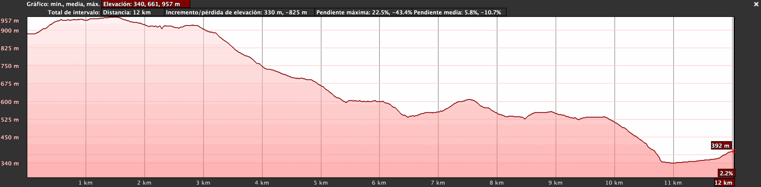
Physical difficulty: Medium-high — Long (11.8 km) with significant negative elevation (-838 m). Demands muscular endurance for the descent and adaptation to the dry southern climate.
Tunte – Caldera de Tirajana -Pueblo de Fataga -Necrópolis de Arteara
Route Start.
Tunte, the historic center of San Bartolomé de Tirajana, is one of the oldest and most emblematic mid-mountain villages of Gran Canaria. Its square, church, traditional houses, and cobbled alleys tell the story of a population that was once the administrative and spiritual center of the region. Surrounded by palm groves, cultivated terraces, and almond trees, Tunte is also a key waypoint on the Gran Canaria section of the Camino de Santiago. Starting the route here means beginning in a place with strong cultural roots, where rural customs, artisanal trades, and a connection to the landscape are still felt. It is the ideal place to introduce the history of the Tirajana caldera, aboriginal routes, and the passage between the summit and the coast that defines this area.
The entire route runs through the Caldera.
The Tirajana Caldera is a large eroded volcanic depression that forms one of the most spectacular geological landscapes in the south of the island. Its walls are made up of cliffs and steep slopes, such as the Tirajana Cliffs,and it is cut through by deep ravines like Fataga and Santa LucíaThese ravines have shaped the territory over millennia and today host a surprising biodiversity, including palm groves, dragon trees, savin junipers, and terraced crops. This environment is ideal for explaining Gran Canaria’s geological formation, erosion processes, and how ancient inhabitants adapted their lives to these rugged terrains. The views during the descent offer a visual reading of the entire caldera landscape, from the highlands to the southern oases.
Passing through the route.
Fataga is one of the most picturesque villages in the south of the island. Known as the “valley of a thousand palms,” it combines a privileged natural environment with very well-preserved rural architecture. Its white houses, cobbled streets, and flowering gardens create an atmosphere of calm and authenticity. The ravine that crosses it has historically been a source of life for its inhabitants, with vegetables, fruits, and cereals cultivated on its slopes. Fataga is also a common stop for walkers and hikers, thanks to its gastronomic offer and hospitality. Here, visitors can learn about the traditional settlement model in the dry mid-mountain zones, water management during times of scarcity, and the transition toward a sustainable tourism economy.
Passing through the route.
This ethnographic and archaeological site is located between Fataga and Arteara, in an elevated area overlooking the ravine. Los Caserones are semi-cave structures that combine reused aboriginal caves with elements of traditional Canarian rural architecture. Many of these dwellings were inhabited until the mid-20th century, preserving corrals, terraces, and traditional bread ovens. Besides their historical value, the site offers panoramic views of the Tirajana valley and stands as a tangible example of cultural continuity from the pre-Hispanic period to the contemporary rural world. It is an ideal place to interpret the evolution of Canarian housing and the use of natural resources over the centuries.
Passing through the route.
The Arteara Necropolis is the largest aboriginal burial site in Gran Canaria. Located on the edge of the ravine of the same name, this necropolis contains over a thousand tumuli made of volcanic stones arranged in circles and mounds. It is believed that high-ranking individuals in pre-Hispanic society were buried here. The location is not accidental: it is oriented toward the rising sun and surrounded by cliffs that were part of the ancient Canarians’ symbolic universe. From an interpretive point of view, Arteara allows discussions about rituals, indigenous astronomy, worldview, social hierarchy, and respect for ancestors. Visiting this archaeological site transforms the route into a journey through time, from the rural present to the island’s deepest past.
End of Route.
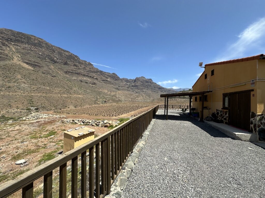
A family-run business dedicated to organic farming and the production of natural cosmetics made with high percentages of aloe vera, exclusively of Canarian origin. One of its most remarkable estates is located in Fataga, in the municipality of San Bartolomé de Tirajana, also known as the “Valley of a Thousand Palms”. Nestled among majestic cliffs, this area is renowned for its rich heritage and archaeological value in Gran Canaria.


This route begins at the top of the majestic Tamadaba Pine Forest, one of the oldest and best-preserved natural areas of Gran Canaria, located within the Natural Park of the same name.
This route begins in the spiritual heart of Gran Canaria: the Marian village of Teror, a starting point steeped in history, faith, and culture.
Departing from the livestock heartland of northern Gran Canaria, the village of San José de Caideros, this route leads us through ancient rural paths flanked by centuries-old chestnut trees, natural viewpoints, and agricultural terraces that still retain the charm of the past.
This linear route connects the traditional village of Tunte (San Bartolomé de Tirajana) with the bottom of the spectacular Fataga Ravine, ending at the aboriginal settlement of Arteara.

Immerse yourself in relaxation, explore the coastline, discover new routes and get into the most captivating nature.


Subscribe to our newsletter to receive all the latest news about the Gran Canaria Walking Festival.