This route begins in the spiritual heart of Gran Canaria: the Marian village of Teror, a starting point steeped in history, faith, and culture. From the Plaza of the Basílica del Pino, the trail descends gently through scattered hamlets and terraced fields, leading us into the lush Barranco del Álamo, a hidden gem once used by traders, shepherds, and pilgrims.
The path winds through cane fields, irrigated lands, and rural estates before climbing into the protected landscapes of Pino Santo, one of the greenest agricultural zones in the municipality of Santa Brígida. The route ends at the San José del Álamo recreational area, a perfect setting to rest under the pine forest and conclude a day that blends nature, ethnography, and tradition.
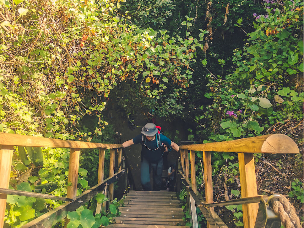
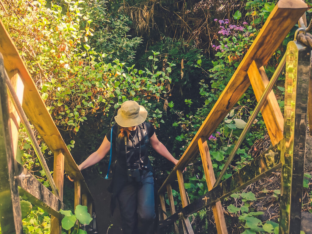
The hike starts at the Plaza of the Basílica de Teror and leads into the deep Barranco de Ojero (also known as Barranco del Álamo), where lush vegetation stimulates all the senses. From there, a gentle but steady ascent takes us to El Faro, the highest point of the route at 817 meters above sea level.
At this point, we are rewarded with views of the Barranco del Laurel, Lomo del Espartero, and El Roquete, which we will descend via ancient royal trails to reach the cool shade of the Barranco del Acebuchal. Finally, after passing through groves of giant eucalyptus trees and wild olive (acebuche), we begin the final ascent to the plateau where San José del Álamo lies—the end of this route.
The trail is of medium difficulty and suitable for a wide audience. There are no technical or exposed sections. It is mandatory to bring at least 2 liters of water, sun protection, a hat or cap, and waterproof clothing in case of rain. Minors aged 16 and over may participate if accompanied. Participants must follow the instructions of the guiding team at all times.
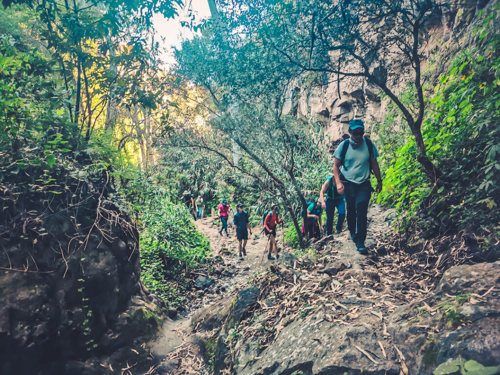
Technical Difficulty – Medium: Varied terrain including narrow trails, ravine crossings, rural paths, and some steep slopes. Requires attention but presents no dangerous sections.
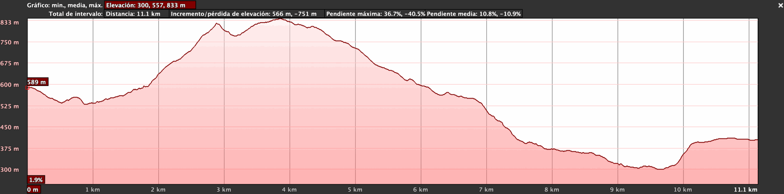
Physical Difficulty – Medium: Moderate distance (11.1 km) with a demanding elevation change (+566 / -751 m), but gradually distributed. Suitable for regular hikers at a calm pace.
Teror – Fuente de Agua de Teror – Barranco del Álamo – Paisaje Protegido de Pino Santo – Lomo del Espartero – Charcas de San Lorenzo – San José del Álamo
Route Start.
The town of Teror is one of the most culturally distinctive in Gran Canaria. Its historic center, declared a site of cultural interest, is home to the renowned Basílica de Nuestra Señora del Pino,patron saint of the island. Her devotion deeply shapes the island’s religious and festive culture. The basilica is a notable example of Canarian religious architecture and houses a 15th-century statue of the Virgin. Every September 8th, thousands of pilgrims walk from all corners of the island to Teror, creating a unique spiritual atmosphere. The town is also known for its traditional wooden balconies, its lively Sunday market, and for being a symbolic starting point for hiking trails that follow ancient transhumance and pilgrimage paths. Starting the hike here means beginning at the cultural and spiritual heart of Gran Canaria.
Close to the Route.
The Fuente Agria of Teror is one of the island’s most famous natural springs, known not only for its historical importance but also for the bottled water brand “Aguas de Teror.” This spring, located near the Barranco del Álamo, has been used for centuries by local residents. Its mineral content and distinctive taste have made it widely known throughout Gran Canaria. Over time, this natural resource has shaped the surrounding agricultural and social landscape. For hikers, it serves as an interpretive point to learn about traditional water use, irrigation systems, and the relationship between people and the environment in the humid northern region of the island.
Passing through the route.
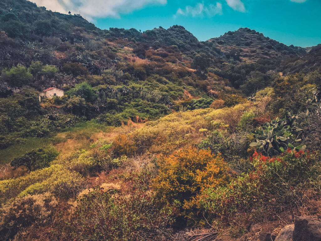
This lush ravine is part of an ecological corridor between Teror and the midlands of Las Palmas. The trail that passes through it has recently been restored and is considered part of the island’s historic footpath heritage. Its slopes are covered with cane, remnant laurel forest, and water-loving vegetation. Along the way, hikers will cross old bridges, dry stone walls, and narrow passes that reflect its past as a communication route between agricultural estates. It’s a prime example of a northern Gran Canaria ravine, with remarkable biodiversity and an environment that invites quiet observation. It's also an ideal location to discuss agricultural traditions, water management, and changes in land use over time.
70% of the Route Passes Through It.
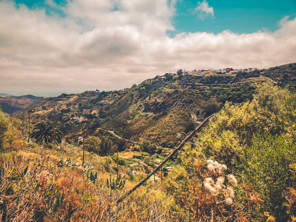
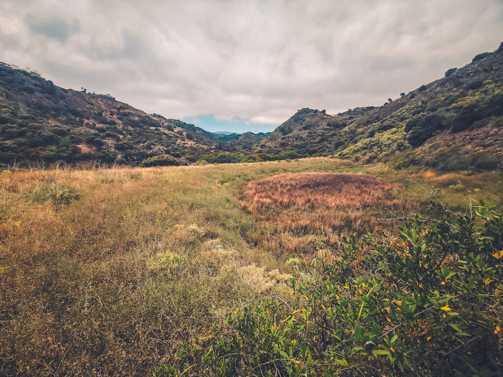
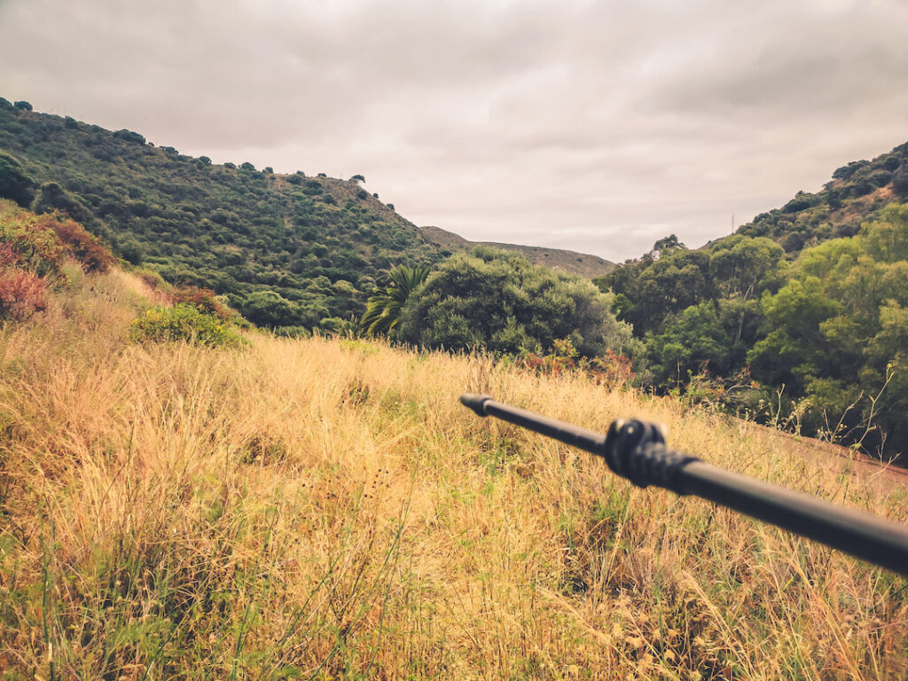
The Pino Santo Protected Landscape is one of the natural treasures of northern Gran Canaria. This area has been designated protected due to its ecological, scenic, and cultural value. It encompasses a broad expanse of midland terrain where wild nature coexists with traditional agricultural practices. The area is characterized by a mosaic of ravines, hills, and slopes covered with native vegetation, fruit trees, palm groves, old terraces, and royal trails. From the path, hikers can enjoy sweeping views of this human-shaped landscape, which reflects centuries of interaction between people and nature. It is an ideal place to discuss landscape multifunctionality, sustainable land management, and the importance of preserving midland zones as green corridors connecting mountains and coast. Its inclusion in this hike adds both ecological and educational value, especially regarding birdwatching and native plant biodiversity.
Passing through the route.
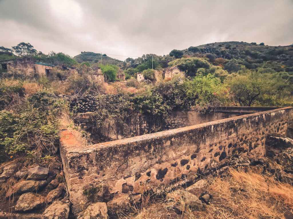
Lomo del Espartero is one of the most prominent elevations along the middle section of the route between Teror and San José del Álamo. This location offers panoramic views of the Guiniguada and Pino Santo valleys and features a mid-mountain landscape dotted with rural homes, disused terraces, and stone walls—testaments to the area’s agricultural past. Its name refers to the historical presence of esparto grass, a plant traditionally used to make ropes, mats, and baskets—staples of local rural life.
Beyond its scenic value, Lomo del Espartero is a great spot to interpret the scattered settlement pattern characteristic of Gran Canaria’s midlands. Here, one can observe how the terrain has historically shaped settlement, roads, and farming practices. It’s also an ideal location for a break and to reflect on the transition from Teror’s rural setting to the more forested areas near the route’s end.
Near the Route.
Close to the San Lorenzo neighborhood are several ponds and traditional hydraulic structures associated with agriculture and urban water supply. These small dams and reservoirs are part of the island’s traditional water engineering, based on springs, water dividers (cantoneras), and stone channels. They illustrate Gran Canaria’s historic struggle to secure water and its strategic importance in the island’s humid midlands.
Passing through the route.
This natural setting, a transition zone between rural and forested environments, is home to the recreational area that marks the end of the hike. Surrounded by pine forests, farmland, and old livestock trails, San José del Álamo is an example of a well-integrated public space. It offers an opportunity to discuss the social use of landscapes, nature-related recreation, and the potential of the midlands as a connecting zone between urban life and the countryside.


This route begins at the top of the majestic Tamadaba Pine Forest, one of the oldest and best-preserved natural areas of Gran Canaria, located within the Natural Park of the same name.
This route begins in the spiritual heart of Gran Canaria: the Marian village of Teror, a starting point steeped in history, faith, and culture.
Departing from the livestock heartland of northern Gran Canaria, the village of San José de Caideros, this route leads us through ancient rural paths flanked by centuries-old chestnut trees, natural viewpoints, and agricultural terraces that still retain the charm of the past.
This linear route connects the traditional village of Tunte (San Bartolomé de Tirajana) with the bottom of the spectacular Fataga Ravine, ending at the aboriginal settlement of Arteara.

Immerse yourself in relaxation, explore the coastline, discover new routes and get into the most captivating nature.


Subscribe to our newsletter to receive all the latest news about the Gran Canaria Walking Festival.